Cargando...
Recursos educativos
-
Nivel educativo
-
Competencias
-
Tipología
-
Idioma
-
Tipo de medio
-
Tipo de actividad
-
Destinatarios
-
Tipo de audiencia
-
Creador
Lo más buscado
- Cáncer
- cuentos inglés
- Arte rupestre
- Guía interactiva
- ejercicios matemáticas
- Geografía de España
- Informática niños
- Repaso y material didáctico adicional
- Actividades de ciencia para niños
- Lagos de Asia
- ejercicios lengua primaria
- Aprender inglés
- leyendas para niños
- Actividades artísticas para niños
- Repaso de sintaxis
-

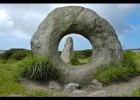
Megaliths
Esdres Jaruchik Organización
- 1 lo usan
- 267 visitas
Images of different places around the world.
-

Answer. A global system (3)
EduBook Organización
- 1248 visitas
How can events in one part of the world affect another part of the world immediately?
-

118 mapas interactivos espectaculares
Carlos Morales Docente
- 2 lo usan
- 3007 visitas
118 mapas interactivos de la sección Maps of the Week de Google Maps Manía, Keir Clarke muestra los mapas más espectacular de cada semana con la API de Google.
-

Website: Community walk
Tiching explorer Organización
- 1 lo usan
- 4865 visitas
This website allows us create personal maps. We can include sites on a map with descriptions and images. We can use the maps to describe field trips, report on historical events, and do other mapping…
-

Spicynodes
Tiching explorer Organización
- 1 lo usan
- 2863 visitas
Online tool that allows us create mind maps and nodes. There is an individual free version (that includes their logo in our creations). We can embed the maps in our blog/site.
-

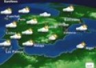
Predicting the weather: Euronews weather forecast
Maria Pallarés Docente
- 3 lo usan
- 16526 visitas
Euronews weather forecast to introduce the symbols of weather maps and analyse weather conditions. Duration: 2.35 minutes.
-

Nighttime!
Ángel Trasobares Castillo Docente
- 1 lo usan
- 3308 visitas
Mapa de la Tierra facilitado por Google Maps donde podemos ver nuestro planeta de día o de noche.
-

Connected Mind
Héctor Espinoza Hernández Docente
- 1 lo usan
- 5200 visitas
Draw unique and memorable mind maps, store them in the cloud for free and access them anywhere
-

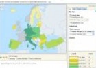
European Union’s population density
Maria Pallarés Docente
- 1 lo usan
- 5683 visitas
Website of the EU statistics office, Eurostat, which has maps on population density of EU countries (1999 to 2010).
-

Build with Chrome
Jordi Mulet Docente
- 1 lo usan
- 3255 visitas
Now you can build with LEGO® bricks using Google Maps as your baseplate. Imagine. Explore. Build online in Chrome.
Te estamos redirigiendo a la ficha del libro...


